A friend of mine created something similar using a numerical optimization based approach to minimize distortion. He also made the artistic choice to split the water between Australia and Asia to get even lower distortion. See Elastic II here:
Elastic II is very neat by preserving drainage basins. But Antarctica looks really distorted, in a way that doesn't seem necessary? Could that be fixed somehow?
Not to mention that no fish would have any insight into at least whatever is within visible distance from the shore surface. An accurate version of such a map would highlight an interesting perspective of how humans also lack the ability to perceive, comprehend, or even accept things they either physically or psychologically cannot perceive or do not wish to perceive and accept it.
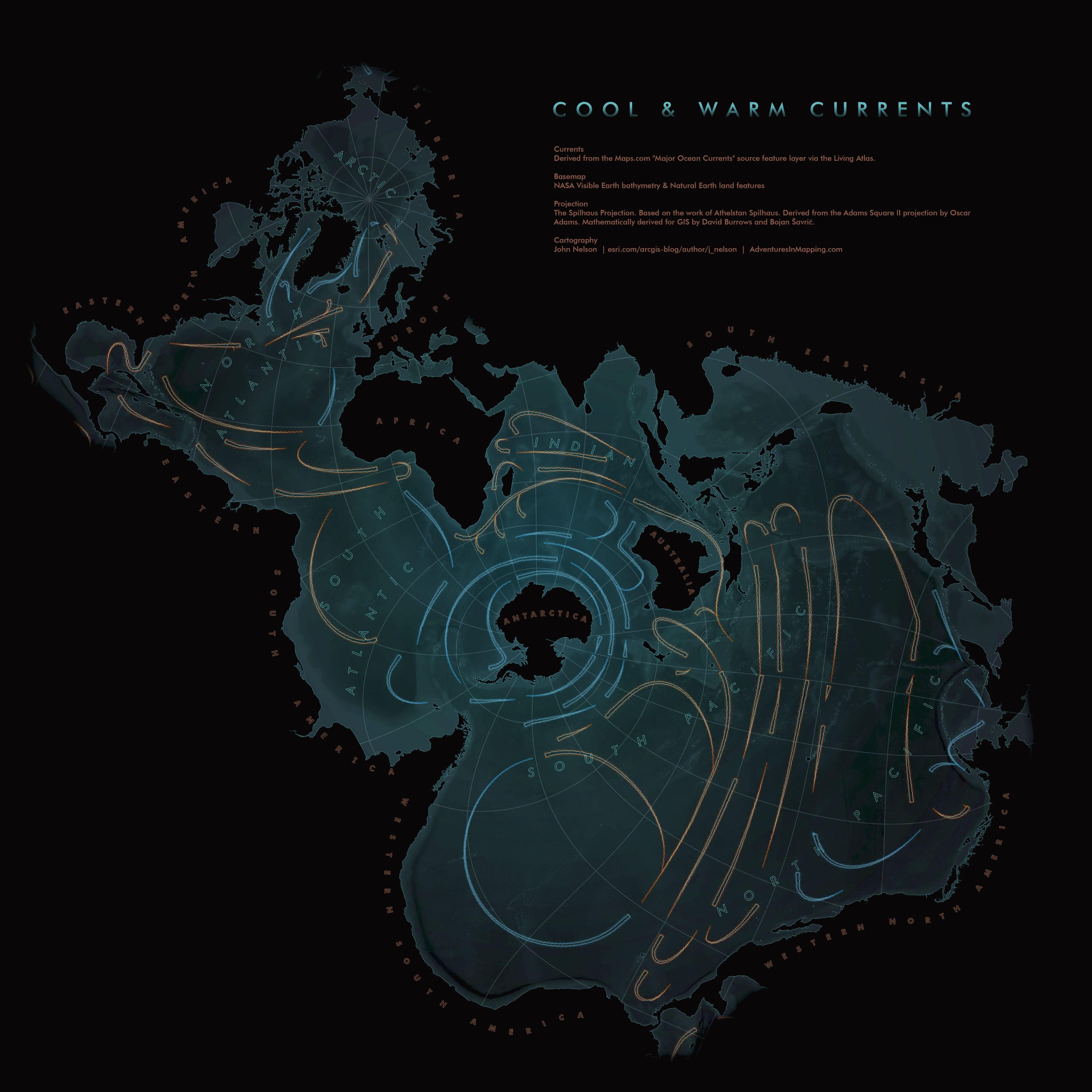
I may be very easy to amuse but but Spilhaus projection for compact Hausdorff space (the surface of the Earth) tickled my drying bones.
Seems the landmasses are indeed housing off all that spilled water.
Humor aside, the first thing it reminded me of is the Quincunx projection. There all the landmass is at the centre and is housed off by the oceans. And you can tile Euclidean space with it.
Is there or could there be an equivalent centered on the north geographic pole?
I'm aware of Polar Stereographic Projections and similar but they don't unify the oceans the way the Spilhaus does.
https://kunimune.blog/2023/12/29/introducing-the-elastic-pro...
reply